
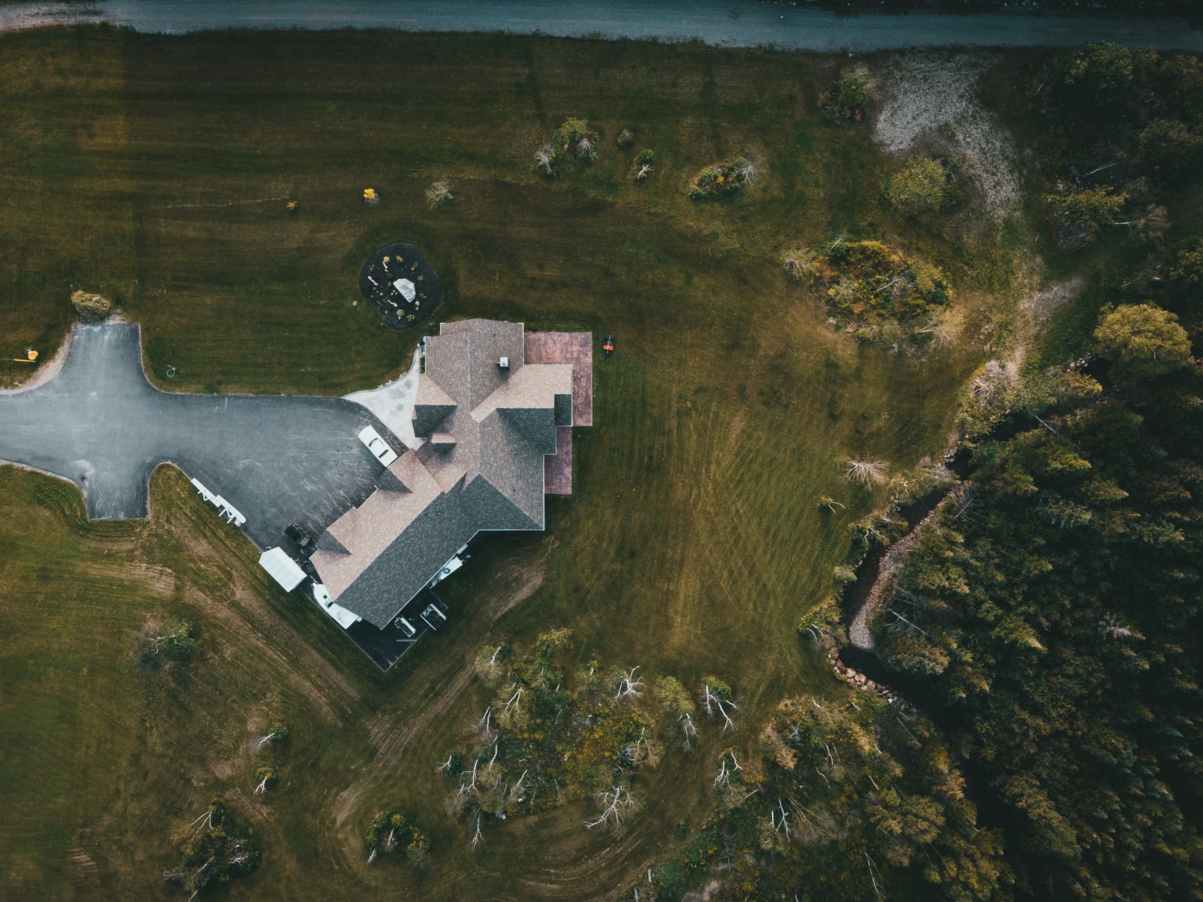
Drone photography for property sales has become one of the most effective ways to show a home in its full context. Where a standard ground-level shot shows a façade, an aerial image shows the block size, the neighbourhood feel, the proximity to parks or water, and the roofline all at once. For buyers scrolling through dozens of listings online, that kind of visual storytelling can be the thing that stops the thumb.
Why aerial imagery resonates with buyers
Most buyers are not just purchasing a building. They are purchasing a location, a lifestyle, and a set of surroundings. Drone photography communicates all three in a single frame. A well-composed aerial shot of a property with a large rear garden, a swimming pool, or a north-facing aspect tells a buyer something no floor plan or interior photo can. It gives them a sense of place before they even book an inspection.
This matters particularly for properties on larger blocks, acreage, or waterfront positions, where the land itself is part of the value proposition. But it also adds real value for suburban homes, townhouses near parks, and properties in tightly held pockets where proximity to amenities is a genuine selling point. Professional property photos sell homes faster precisely because they give buyers confidence in what they are buying, and drone imagery extends that confidence to the exterior and surroundings.
What drone photography can capture that ground-level shots cannot
A licensed drone operator working at the right time of day can produce a wide range of shots that go well beyond a simple top-down overhead. Here is what a good aerial session typically covers:
- Elevated façade shots: taken at a low angle from 10 to 30 metres, these show the full front of the property without the distortion of a wide-angle lens pressed close to a fence line.
- Block overview: a higher-altitude shot that shows the full land parcel, boundary lines, driveway, and any outdoor structures like sheds, garages, or pools.
- Neighbourhood context: pulled back further to reveal street position, nearby parks, schools, or coastlines that make the location compelling.
- Sunset or twilight aerials: paired with a twilight shoot, aerial images taken at golden hour are visually striking and perform exceptionally well on property portals and social media.
- Drone video flyovers: smooth cinematic footage that gives online buyers a guided tour of the exterior and surrounds before they visit in person.
When drone photography is most valuable
Not every property benefits equally from aerial imagery, but the use case is broader than most vendors assume. The strongest candidates include:
- Properties on blocks over 500 square metres where land area is a key feature.
- Homes with pools, outdoor entertaining areas, or significant landscaping not visible from the street.
- Acreage, rural, or semi-rural properties where the aerial view shows infrastructure across a large area.
- Waterfront, hinterland, or elevated properties where the outlook is a primary selling point.
- Developments and prestige listings where a premium visual package is expected by buyers.
Even a modest suburban home can benefit from one well-placed aerial to show its street, rear access, or double garage footprint in a way that ground-level photos simply cannot convey.
Regulations and what to look for in a drone operator
In Australia, commercial drone photography for real estate falls under the Civil Aviation Safety Authority's (CASA) regulations. Any operator flying commercially must hold a Remote Pilot Licence (RePL) and their operating business must have a Remote Operator Certificate (ReOC). These are not optional formalities. They exist to protect the public, neighbouring properties, and the vendors themselves from liability.
When hiring a photographer who includes drone services, always confirm their licences are current. A reputable operator will carry liability insurance, know the local airspace restrictions (particularly near airports, hospitals, or parks), and obtain the necessary approvals before the shoot day. Cutting costs with an unlicensed operator puts the entire shoot, and potentially the listing, at risk.
The Civil Aviation Safety Authority publishes current drone rules and a public register of certified operators, which is worth bookmarking if you are coordinating shoots regularly.
Getting the most from your drone shoot
A drone session is only as good as the preparation behind it. Before the operator arrives, the same principles that apply to any real estate shoot hold true at the macro scale. Bins should be moved off the verge, cars cleared from the driveway, and any loose items tidied from outdoor areas. Preparing your home for a real estate photo shoot covers the interior, but the same logic applies outside: everything the camera can see should look its best.
Weather and time of day matter more for drone work than for interior photography. Overcast light can flatten an aerial beautifully, removing harsh shadows across a roofline, but strong wind grounds the drone entirely. A good operator will monitor Bureau of Meteorology forecasts closely and have a contingency session date built into the booking. Morning light from the east works best for east-facing façades; afternoon light suits west-facing elevations. Discuss orientation with your photographer before the shoot date so you can schedule accordingly.
Drone imagery in the context of a full marketing package
Aerial photography works best as part of a complete visual marketing suite rather than as a standalone add-on. A listing that combines crisp interior stills, a twilight exterior, floor plan imagery, and two or three hero aerials gives buyers a thorough and emotionally engaging picture of the property across every digital touchpoint: portal listings, social media, digital brochures, and agent newsletters. Each format has a different role, and drone imagery fills the gap that no ground-level shot can cover.
For vendors and agents looking to differentiate in a competitive market, drone photography is no longer a premium novelty. It is a practical tool that answers the questions buyers are already asking before they reach out for an inspection. Give them the aerial view, and you give them a reason to come through the door.